New Orleans Public Space - Ecology
New Orleans is categorized as a food desert, but why is that?
The USDA’s definition of a food desert is “A low-income tract with at least 500 people, or 33 percent of the population, living more than one-half mile (urban areas) or more than 10 miles (rural areas) from the nearest supermarket, supercenter, or large grocery store.”
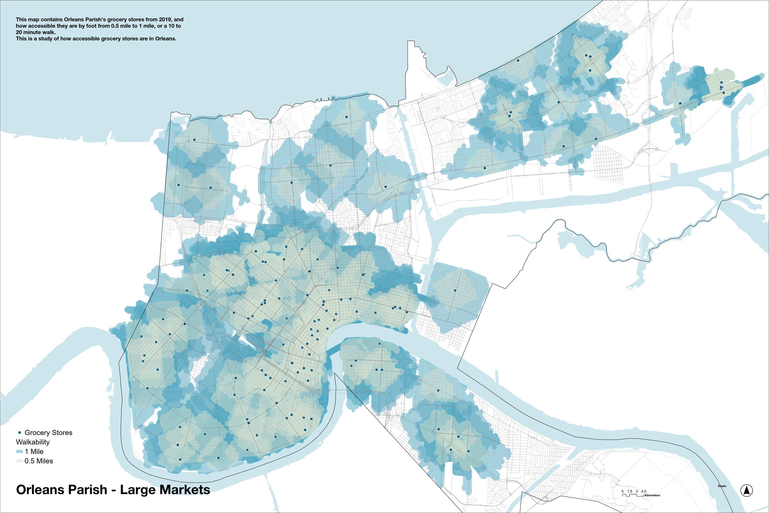
To start, we need to look at grocery store accessibility. This is a 2019 map of grocery stores, with a walkability map ranging from 0.5 mile to 1 mile. NOLA grocery stores cover most of the city, but not enough.
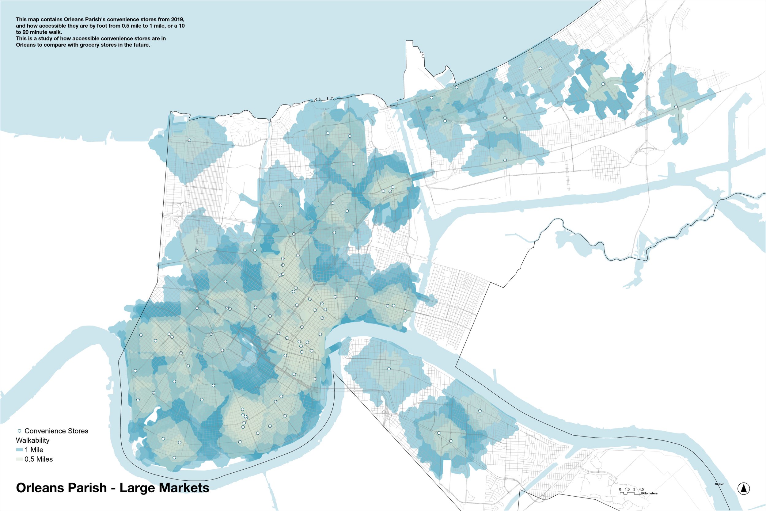
This map shows convenience store accessibility. Corner stores are not great source of nutritional food and produce, but they can act as a supplement to grocery stores. This is particularly true in new Orleans, where there are many gaps to fill. These small-scale stores may be onto something.

Adding grocery stores and corner stores onto one map raises store density, while also demonstrating that areas like the West bank (across the Mississippi river) and New Orleans East are underserviced. Still, Uptown and downtown (the area along the lower river bend) have good access, even if not to quality produce.
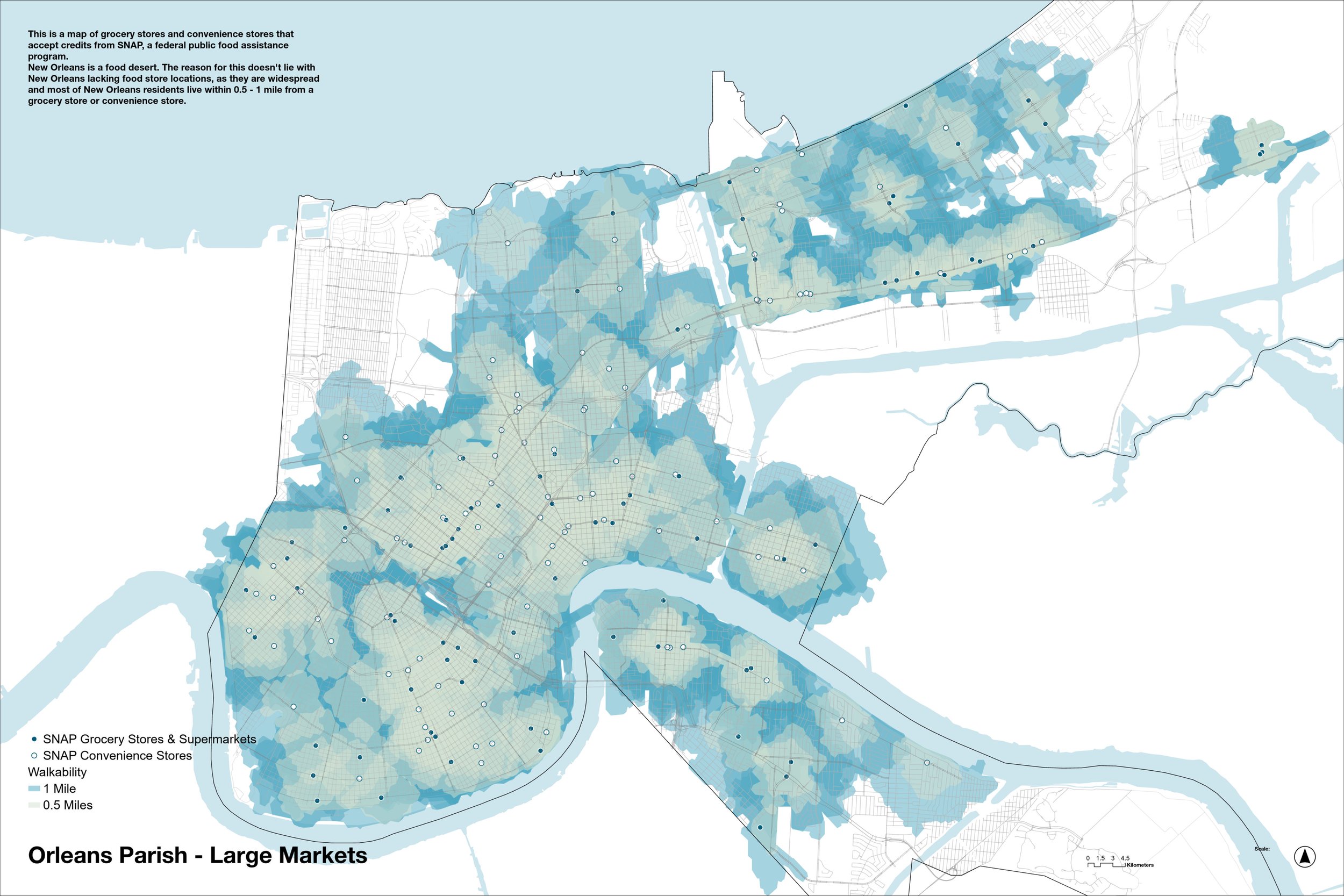
Taking a look at government food assistance programs - here is a 2024 map tracking grocery and corner stores that accept SNAP. There is a drop in density, particularly in Lakeview (top left). Still, the densest populated parts of the city are within walking distance of stores. So there are two problems that need solving; what makes an area a target for grocers, and what can we do to make quality produce accesible?
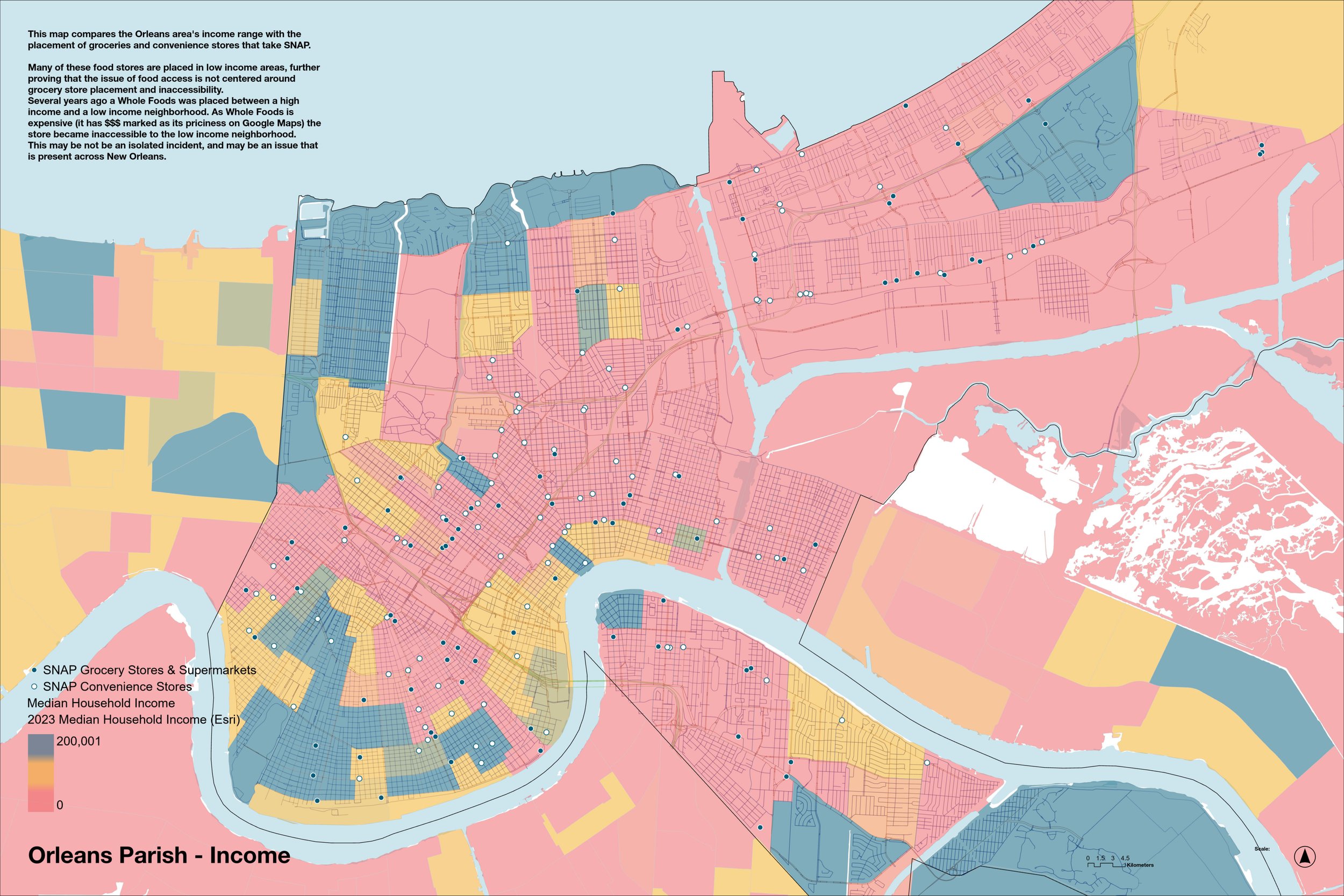
Comparing grocery stores and convenience stores to New Orleans median income shows that although grocery and convenience stores are present, they may not be affordable for residents to shop at on a regular basis.
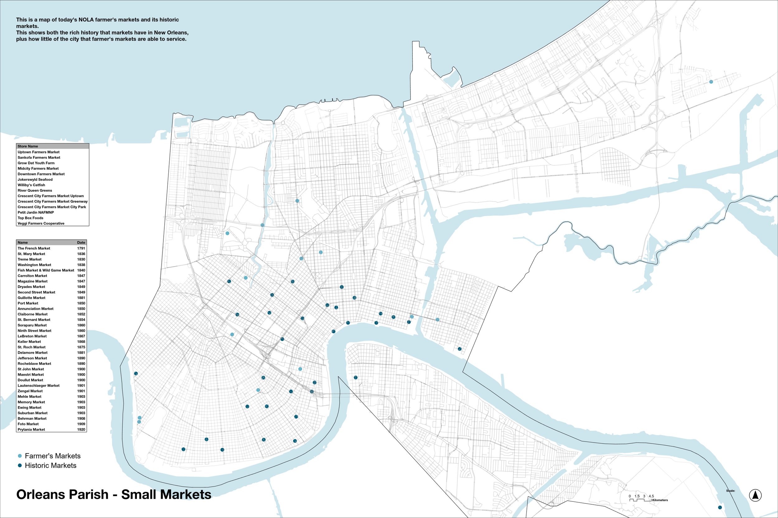
My solution is going small scale, and decentralizing grocery power from big stores like Rouse's, Winn-Dixie, and Walmart. To do this I mapped New Orleans' historic markets, along with today's active farmer's markets. New Orleans has a long history of markets dating back to the founding of the French Market in the 1700s.

Urban gardening could also be a solution to make quality produce more accessible. This map of community gardens shows open gardens, gardens that have closed and been redeveloped, and gardens whose footprints still exist but are inactive. There are currently around 50 community gardens in New Orleans, but during a boom in the 80s that count reached 154. Founding more community gardens would both strengthen neighborhood bonds, and spread access to quality produce in areas not reached by grocers or current community gardens.
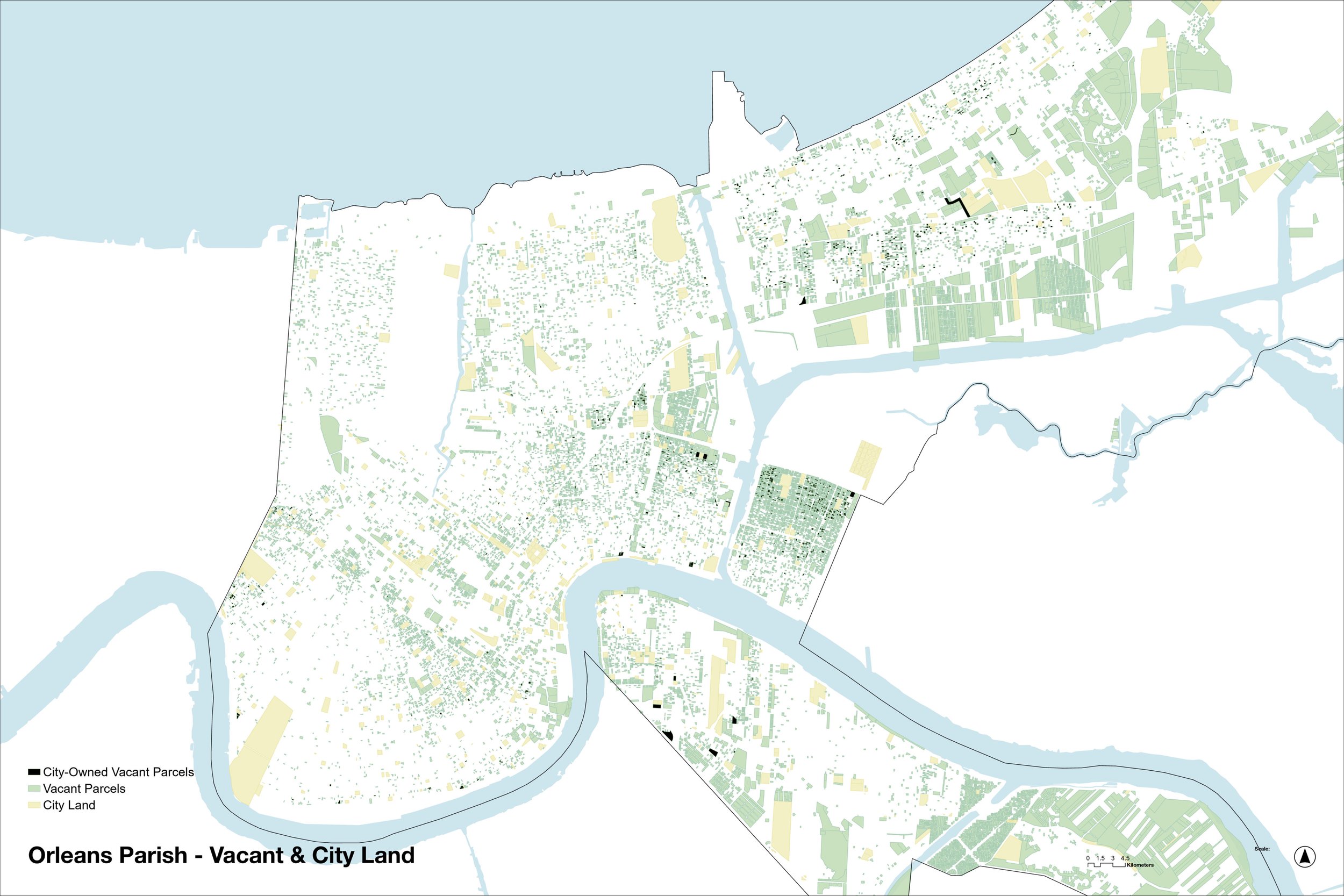
This map of vacant lots begins looking into potential garden and market sites. New Orleans is inundated with vacant lots and abandoned buildings. By layering city-owned property and finding the lots that they have in common, we can pinpoint areas that the city government could use to take action and develop more community gardens, and also general community resources.
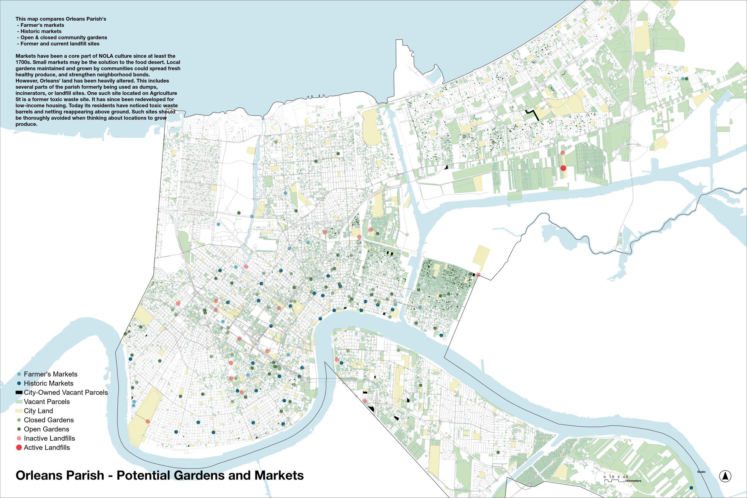
In combining the previous maps, we can find areas that need community gardens, and the sites that are available for development.
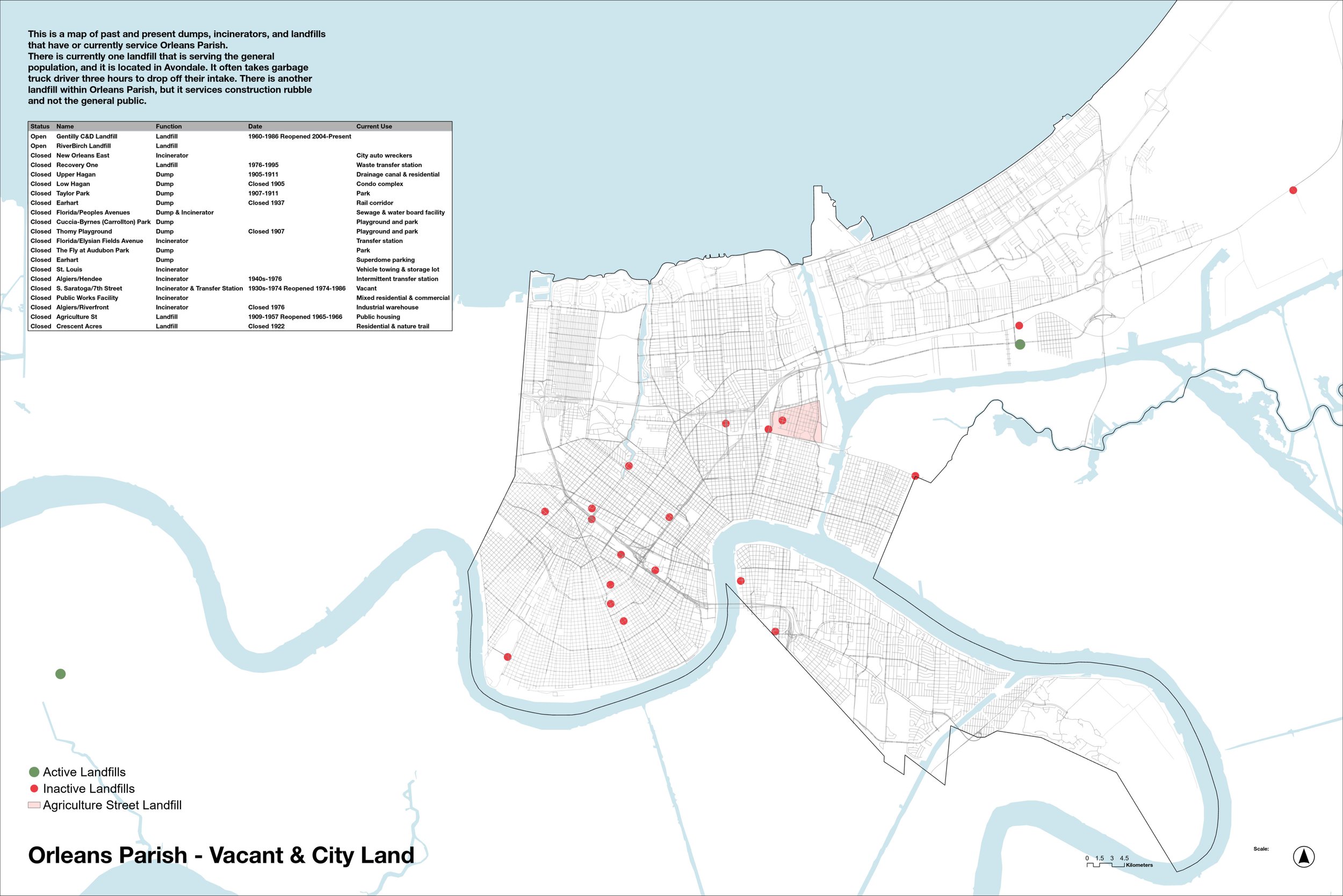
However, New Orleans is an old city. Areas of the city are former dumps and so the land is filled in with trash. This included Agriculture St (highlighted in pink), which used to be a toxic waste dump and incinerator site. The city covered it up and built a low-income residential development atop it in the 70s. Current residents are having barrels and other toxic waste pop up in their backyards, and the land is severely contaminated. One resident was quoted in an article saying that he has a fruit tree that he cannot eat from. These sites should not be developed into gardens.

The dark blue areas of this map show how vulnerable the edges of Louisiana's coast are to washing away. This demonstrates how Louisiana is gradually losing land mass.
